Revolutionize Your Land Surveying with NavGripo Handheld GPS
Looking for Accurate Land Measurements?
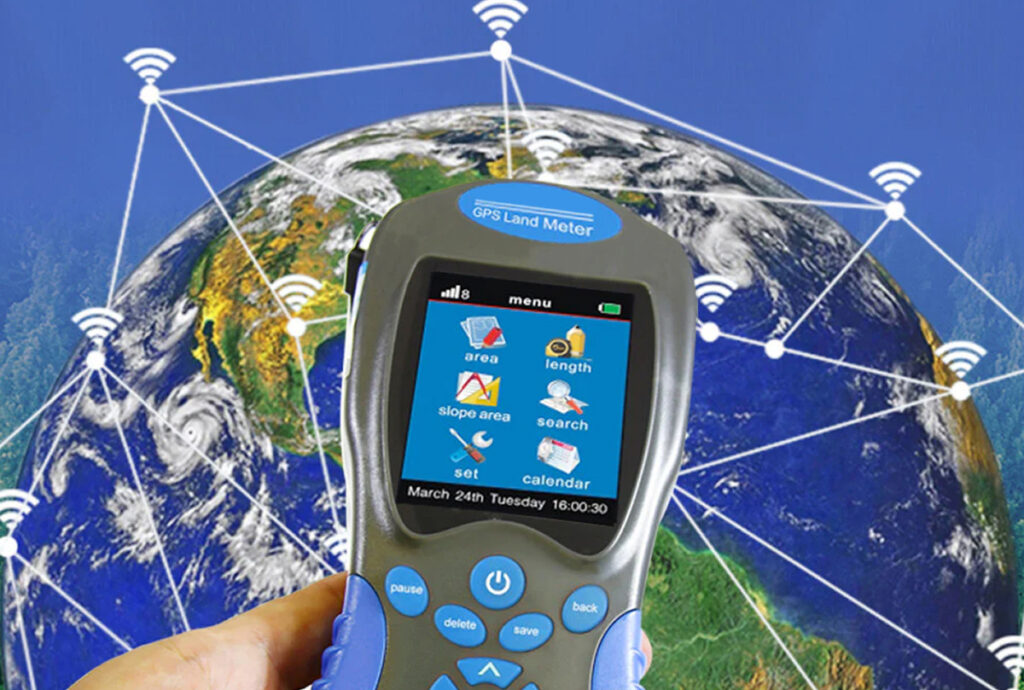
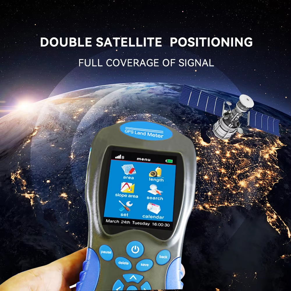
The NavGripo Handheld GPS delivers professional-grade accuracy with ±3% measurement precision, making it ideal for farmers, surveyors, and land managers. Its advanced satellite tracking ensures reliable data even in challenging outdoor conditions, eliminating guesswork and costly mistakes.
Tired Of Complex Surveying Equipment?
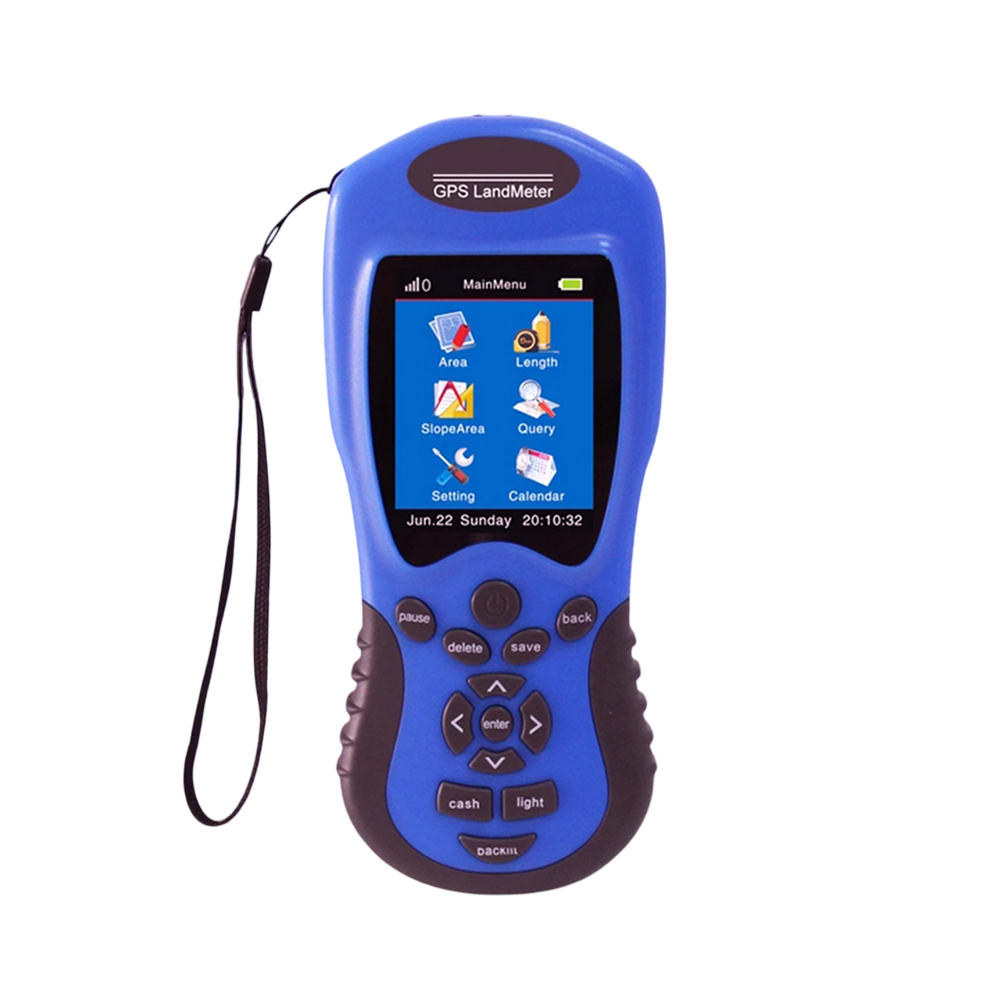
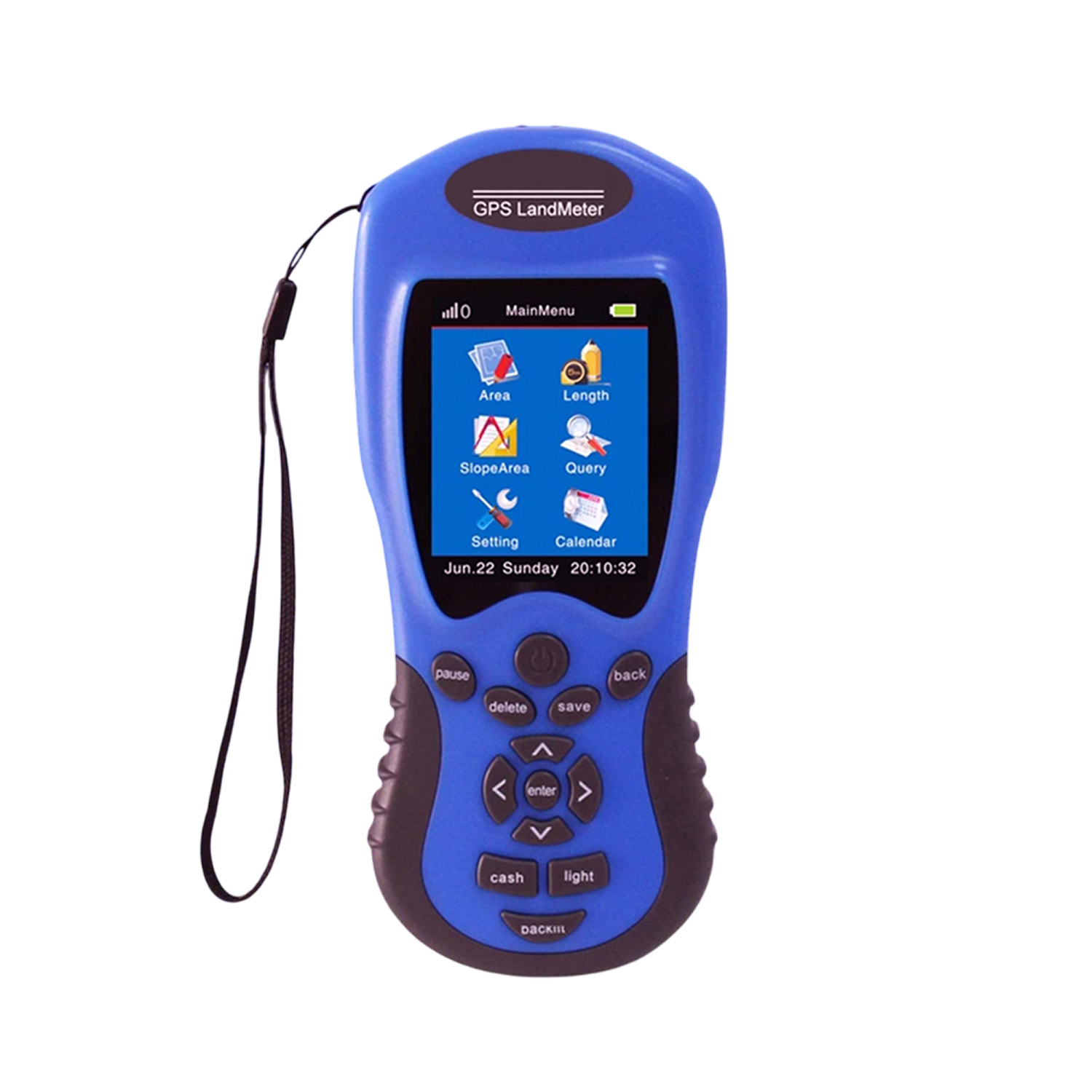
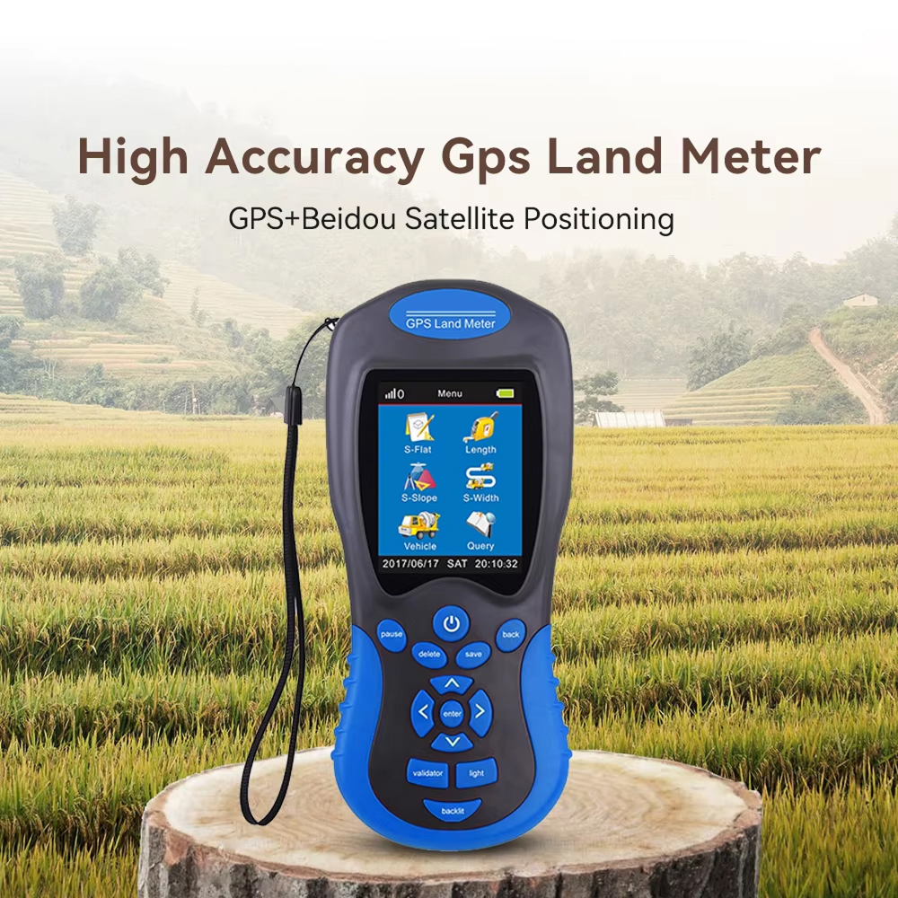
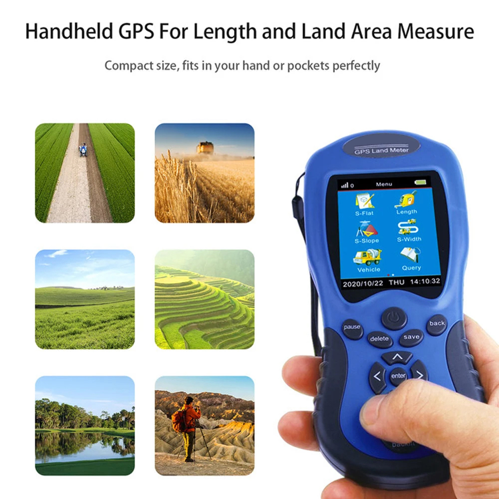
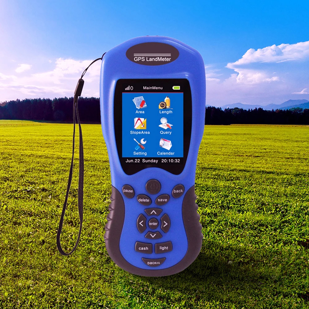
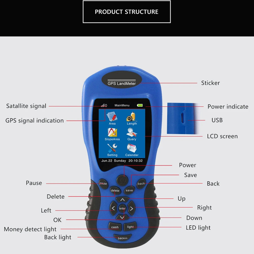
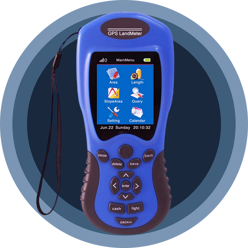
Say goodbye to bulky, complicated surveying tools. The NavGripo GPS features an intuitive interface with a 2.8-inch color display, making land measurement accessible to professionals and beginners alike. Its lightweight design (174x76x28mm) ensures easy portability without sacrificing functionality.
Worried About Outdoor Measurement Errors?
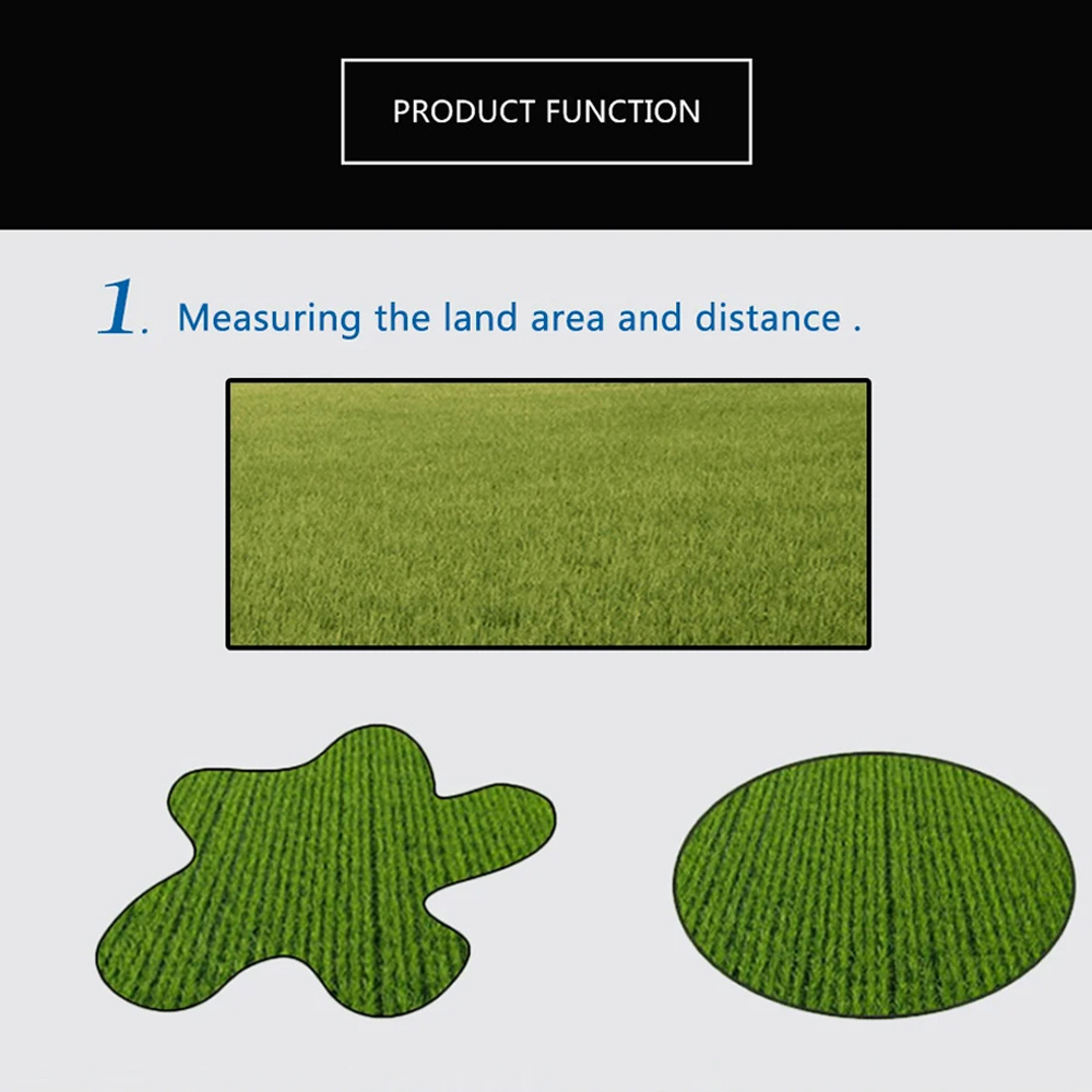
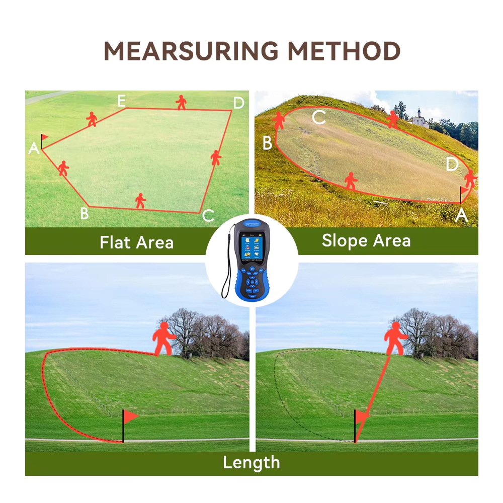
With NavGripo’s advanced GPS technology, you can trust your measurements in various terrains, including slopes and irregular plots. The device automatically compensates for environmental factors, providing consistent results you can rely on for important land management decisions.
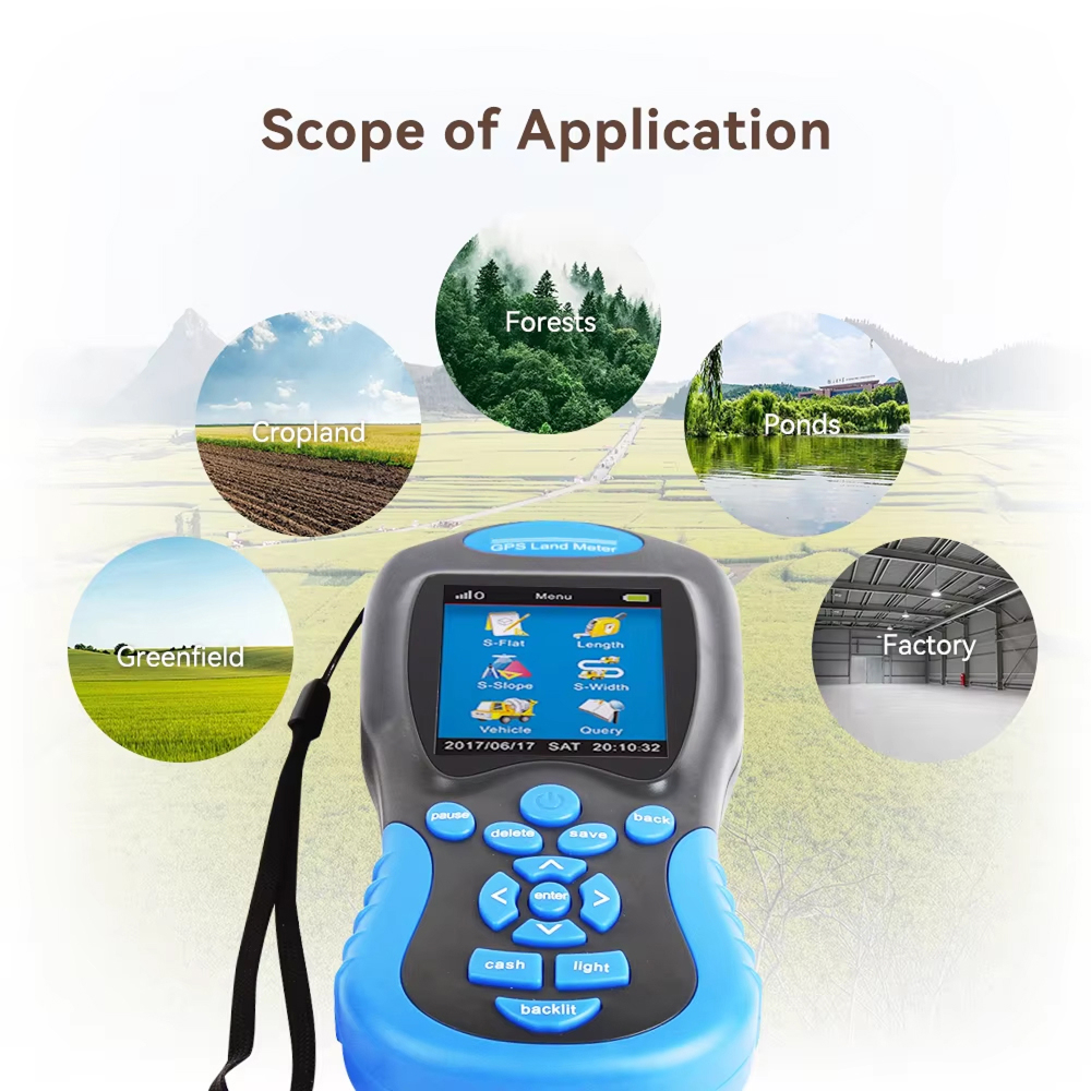
Advanced Features for Comprehensive Land Management Solutions
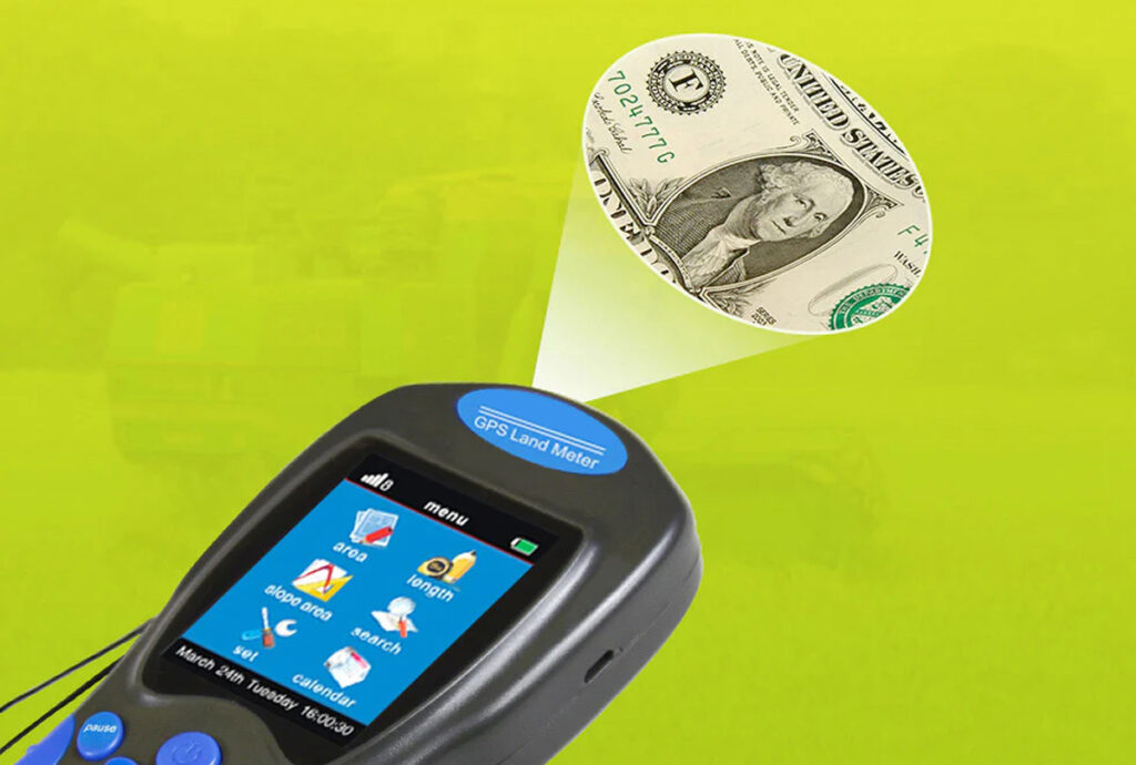
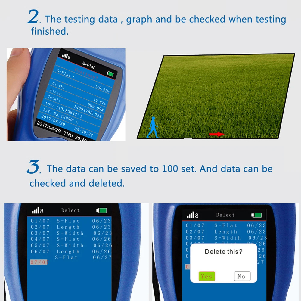
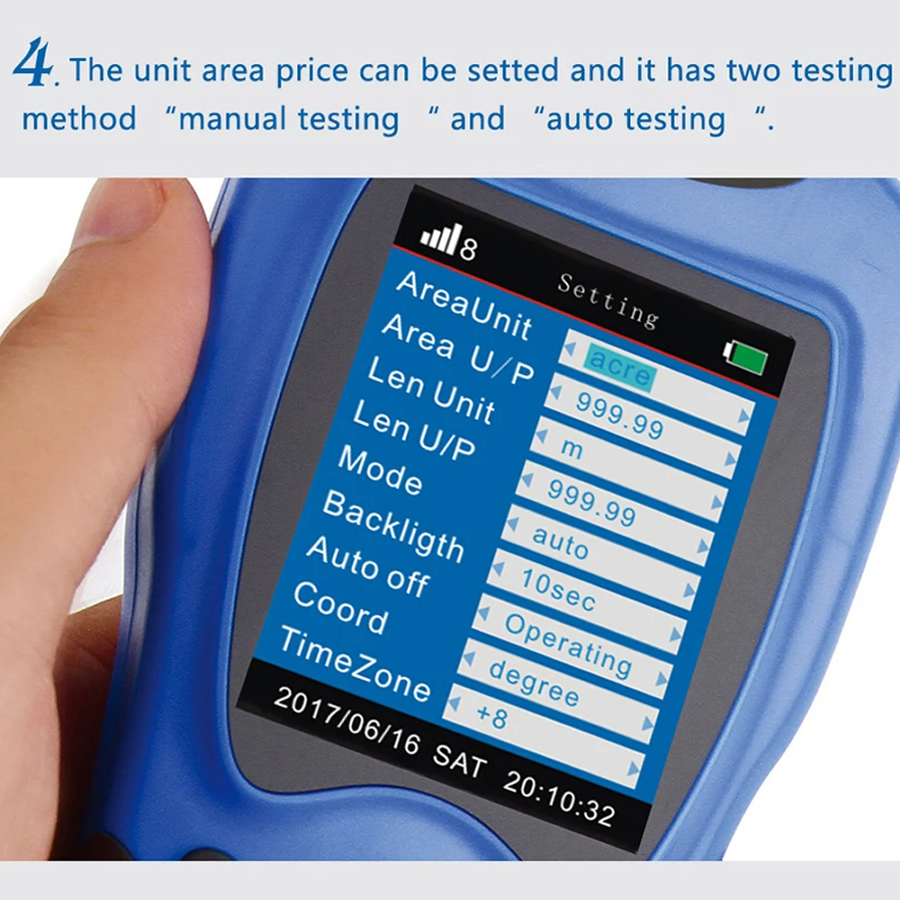
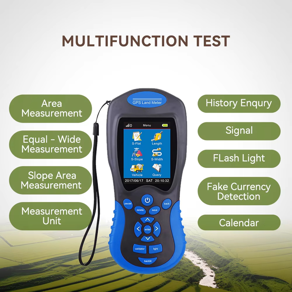
Beyond basic measurements, the NavGripo GPS offers versatile functionality including price calculations, historical data storage, and multiple unit conversions. Its rugged design withstands outdoor use while maintaining user-friendly operation for all skill levels.
The NavGripo GPS sets a new standard for handheld surveying devices with its combination of accuracy, durability, and user-friendly design. Professionals will appreciate its robust feature set while beginners find it surprisingly accessible.
With ±3% accuracy and 0.5-3 meter length measurement precision, the NavGripo GPS delivers professional-grade results suitable for land surveys, agricultural planning, and property assessments.
LONG BATTERY LIFE
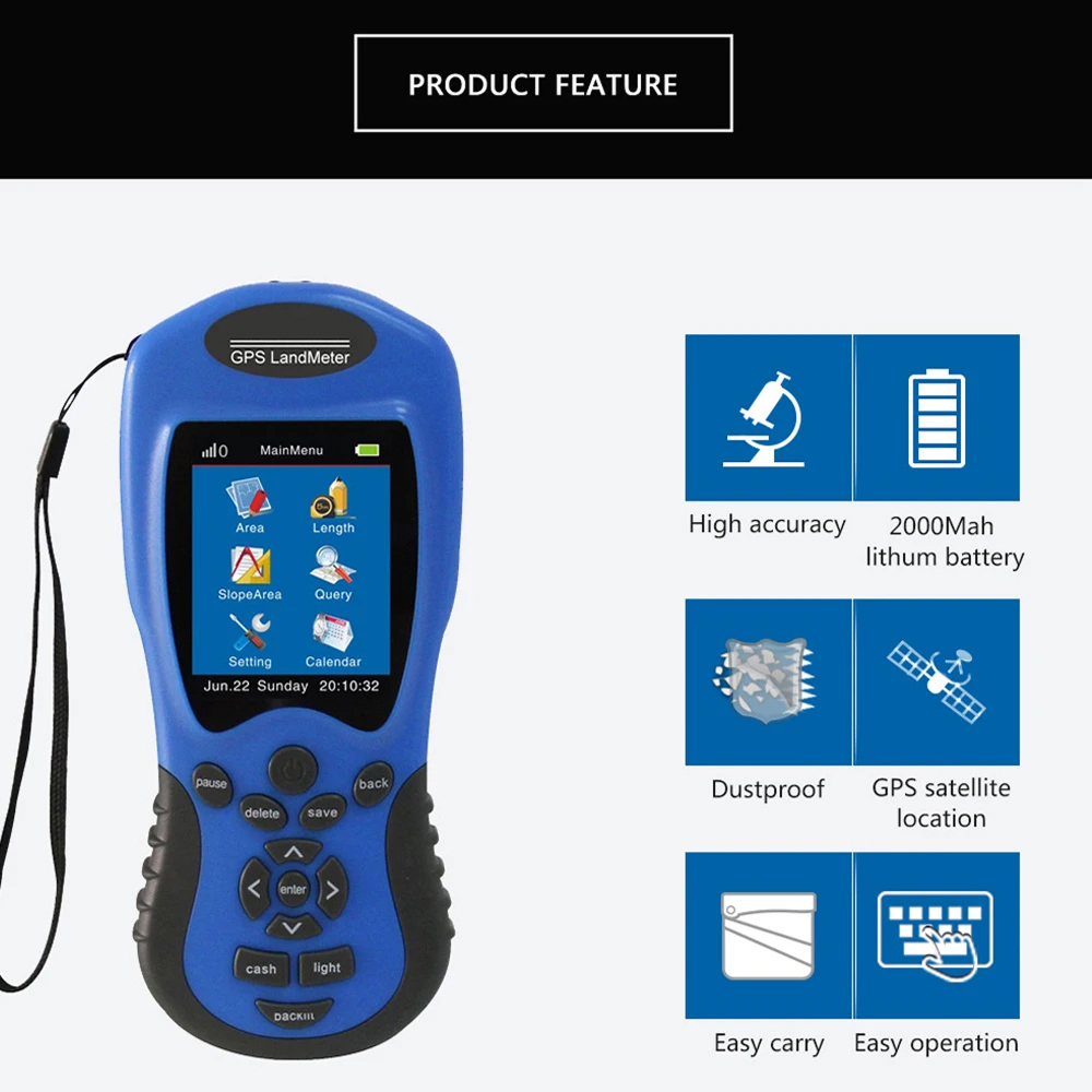
The 2000mAh lithium battery provides 8-10 hours of continuous operation, ensuring you can complete full-day surveying projects without interruption or the need for frequent recharging.
VERSATILE MEASUREMENT OPTIONS
Measure areas of any shape, including challenging slopes, with automatic, manual, or constant width methods. The device adapts to your specific measurement needs with flexible options.
USER-FRIENDLY INTERFACE
The large 2.8-inch color display and intuitive menu system make complex measurements accessible to users of all experience levels, reducing training time and improving productivity.
DURABLE OUTDOOR DESIGN
Built to withstand outdoor conditions, the rugged casing protects the device from dust, moisture, and accidental drops, ensuring reliable performance in various environments.
COMPREHENSIVE DATA MANAGEMENT
Store up to 100 measurements with graphical tracks, enabling easy reference, comparison, and documentation for future projects or client reporting requirements.
Image Gallery
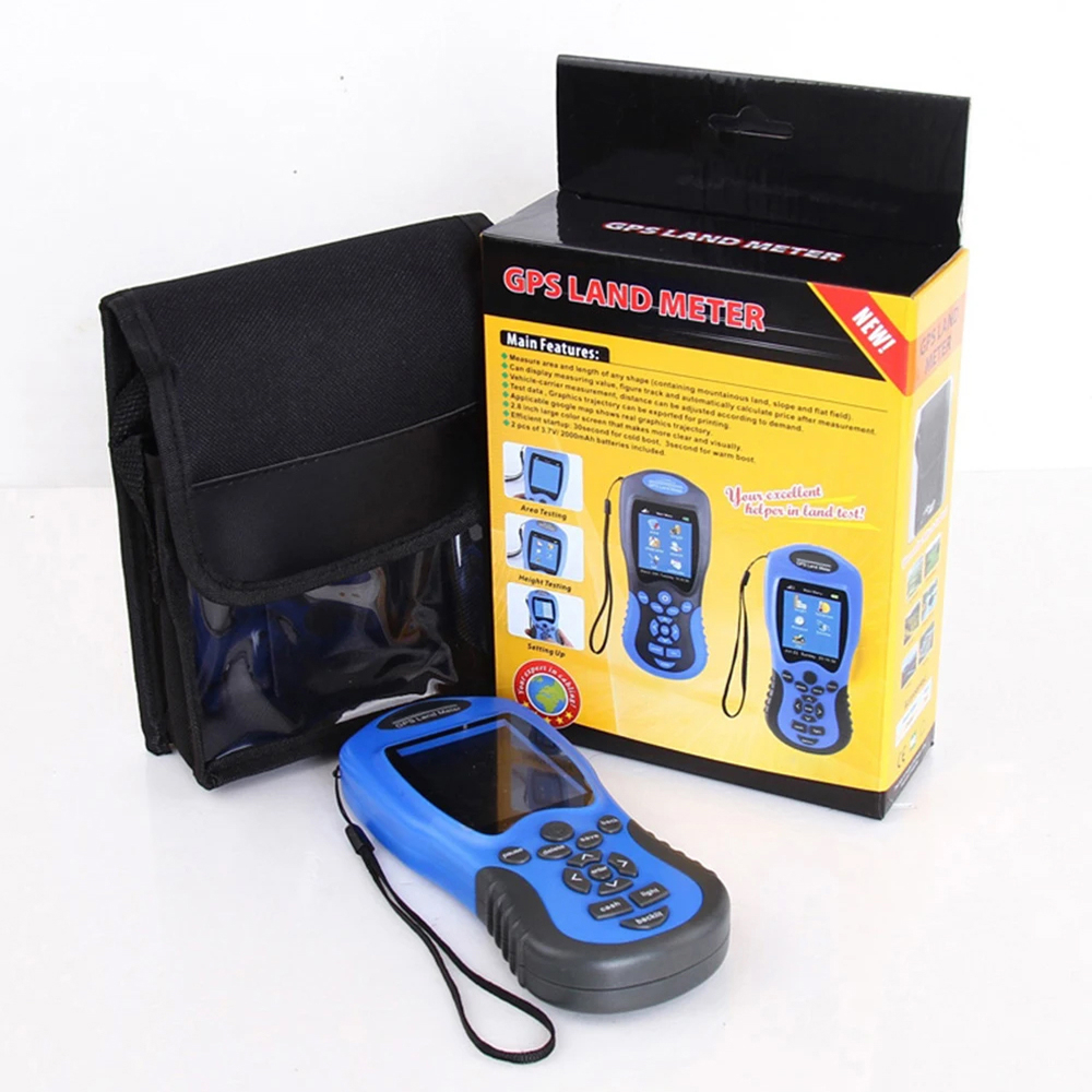
What's Included in Your Package
1 Pcs x NavGripo Handheld GPS
1 Pcs x Charging Adaptor
1 Pcs x Charging Cable
1 Pcs x Product Instructions
1 Pcs x Carry Bag
24/7 Customer Support
We understand the value of your time. That’s why our team is trained to respond promptly and efficiently, ensuring your queries and issues are addressed without unnecessary delays.
Learn More About NavGripo
Frequently Asked Questions
How accurate is the NavGripo Handheld GPS for small land areas?−
The NavGripo GPS provides accurate measurements for areas as small as 0.3 mu, though for optimal precision we recommend using it for larger plots where satellite signals are strongest.
Can the NavGripo GPS measure irregularly shaped plots?+
Yes, the NavGripo GPS excels at measuring irregular shapes including triangular, circular, and polygonal plots. Simply walk the perimeter and the device automatically calculates area and perimeter.
What's the maximum distance the NavGripo GPS can measure?+
The NavGripo GPS can measure lengths up to 999,999.99 meters (approximately 621 miles), making it suitable for large properties, agricultural fields, and construction sites.
How does the NavGripo GPS perform in wooded areas?+
While the NavGripo GPS performs best in open areas, its enhanced receiver can maintain satellite lock in lightly wooded areas. For dense forests, we recommend taking multiple measurements.
Can I transfer data from my NavGripo GPS to a computer?+
Currently, the NavGripo GPS stores data internally (up to 100 records) for on-device reference. Future models may include data export capabilities for computer analysis.
How long does it take for the NavGripo GPS to acquire satellites?+
The NavGripo GPS typically acquires satellite signals within 1-2 minutes in open areas. For first-time use or after long storage, it may take slightly longer to establish initial connection.
What maintenance does the NavGripo GPS require?+
The NavGripo GPS requires minimal maintenance - just keep it clean and dry. The rechargeable battery lasts for hundreds of cycles before needing replacement under normal use conditions.
Is the NavGripo GPS suitable for professional surveying work?+
While not replacing professional survey equipment, the NavGripo GPS provides sufficient accuracy for many agricultural, landscaping, and preliminary surveying applications at a fraction of the cost.
TOP #1 FAVORITE Handheld GPS
Trusted by Thousands of Satisfied Customers
Robert Henderson
As a farm manager, I’ve used the NavGripo GPS for six months to measure our fields with impressive accuracy. It’s saved us countless hours compared to traditional methods, and the battery life easily lasts through full workdays. The automatic area calculation is particularly useful when planning crop rotations.
Amanda Wilkins
The NavGripo GPS has been a game-changer for my landscaping business. Measuring irregularly shaped yards is now quick and precise. Clients appreciate seeing the digital measurements and diagrams – it adds professionalism to our estimates. The durable construction has held up well to daily job site use.
James Peterson
For the price, the NavGripo GPS offers exceptional value. I use it for property assessments and the measurements consistently match official records. The large display is easy to read in sunlight, and the multiple unit options eliminate conversion errors. Highly recommended for real estate professionals.